A30
https://maps.app.goo.gl/YgY8xoWFm8U2m4gh7
Could this be here? Obviously the clay mine dump is less prominent and covered in vegetation.
Magical Mystery Tour Location Question
Re: Magical Mystery Tour Location Question
On second thoughts this isn't a good comparable, but there are better ones along the stretch of the A30.Sn00ker wrote: ↑Tue Sep 27, 2022 8:31 pm A30
https://maps.app.goo.gl/EnertzhgAeN72Mww7
And this is a similar view/skyline to here. Thoughts?
Re: Magical Mystery Tour Location Question
https://www.google.co.uk/maps/@50.50684 ... 312!8i6656
I think this is possible match, bearing in mind that the A30 has been widened.
I think this is possible match, bearing in mind that the A30 has been widened.
- Attachments
-
- Capture2.PNG (1.1 MiB) Viewed 1045 times
-
[flabbyroad]
- Posts: 203
- Joined: Thu Mar 04, 2021 8:26 pm
- Been thanked: 19 times
Re: Magical Mystery Tour Location Question
If you google on Hawkstor China Clay works, some say it was a landmark on the A30 and you'll find a photo of the eighties for the spot:Could this be here? Obviously the clay mine dump is less prominent and covered in vegetation.

It fits with the old map;
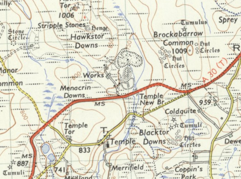
So perhaps not a 100% proof, I think you found the right spot and it solves also the Fork question and filling another gap in the route:
fl.My thinking is that the fork in the road used to be here:
England
https://maps.app.goo.gl/L56MQc9EPoJVaHiu7
We'll not know until we find a location from the 15th between Bodmin and the RAC box at Whiddon Down
Re: Magical Mystery Tour Location Question
Maybe also A30 north of Bodmin?[flabbyroad] wrote: ↑Sat Sep 24, 2022 6:51 pm
The any suggestions on the AA box?

My idea so far; Blackdown Hills, Monkton near Honiton. Problems, skyline don't exactly match, it is not on the route, riding in the wrong direction (Perhaps the 11th? perhaps the footage is mirrored?)
https://www.google.nl/maps/@50.838876,- ... ,12z?hl=en
fl.

https://www.google.co.uk/maps/@50.50447 ... 312!8i6656
Although there"s no AA telephone box on the old map
-
[flabbyroad]
- Posts: 203
- Joined: Thu Mar 04, 2021 8:26 pm
- Been thanked: 19 times
Re: Magical Mystery Tour Location Question
You could be right about the A30 and there is an AA-box:Maybe also A30 north of Bodmin?
https://www.google.co.uk/maps/@50.50447 ... 312!8i6656
Although there"s no AA telephone box on the old map
https://www.theaa.com/resources/Documen ... o-1962.pdf
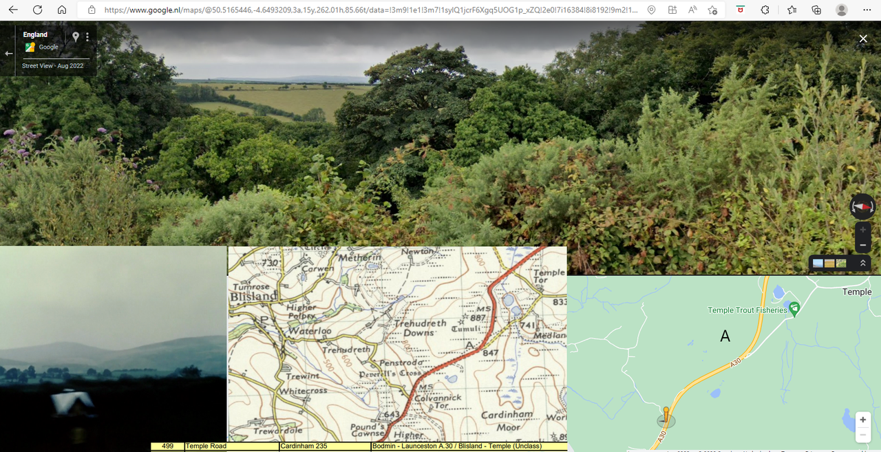
(It's difficult to match Streetview, perhaps impossible, with the screenshots but the landscape near Blisland with walls and hedges it could do.)
fl.
Re: Magical Mystery Tour Location Question
Ah yes, didn't spot that on the old map[flabbyroad] wrote: ↑Mon Oct 03, 2022 7:33 pmYou could be right about the A30 and there is an AA-box:Maybe also A30 north of Bodmin?
https://www.google.co.uk/maps/@50.50447 ... 312!8i6656
Although there"s no AA telephone box on the old map
https://www.theaa.com/resources/Documen ... o-1962.pdf
(It's difficult to match Streetview, perhaps impossible, with the screenshots but the landscape near Blisland with walls and hedges it could do.)
fl.
Re: Magical Mystery Tour Location Question
Looking at this again I think this is a good matchSn00ker wrote: ↑Wed Sep 28, 2022 10:33 am https://www.google.co.uk/maps/@50.50684 ... 312!8i6656
I think this is possible match, bearing in mind that the A30 has been widened.
- Attachments
-
- Capture2.PNG (1.1 MiB) Viewed 862 times
-
[flabbyroad]
- Posts: 203
- Joined: Thu Mar 04, 2021 8:26 pm
- Been thanked: 19 times
Re: Magical Mystery Tour Location Question
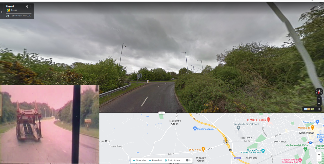
Although this small section seems correct - they go onto the roundabout, pass the turn off for the M4, take the A4 exit, pass the trucks stopped on the right, passed the Fosters pub (there is a building on the right which I suspect is correct but I can't find any reference to it being called Fosters), then passed the Wheatsheaf on the left.
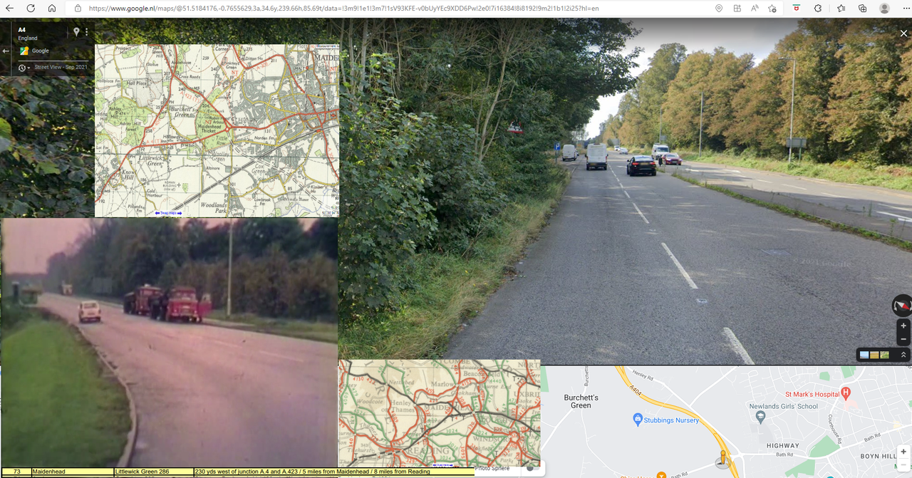
Leaving Henley-on-Thames via A423? Not the same level anymore...
fl.