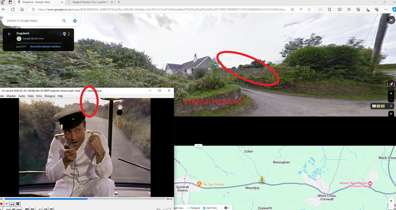
The road has been considerably widened since 1967 with the original road surface left to form the path/verge, which the bus would have followed. The contemporary view of the first clip is then taken from what is now just into the turning they appear to pass on the left. In the second "now" picture we are some distance to the right of where the bus would have travelled (ie the verge on the left) but the cottage with the chimney straight ahead looks right, as do the telegraph poles on the left.
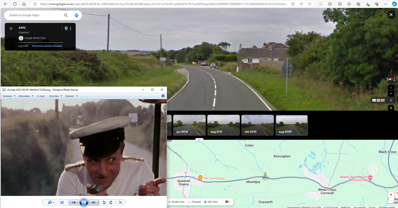
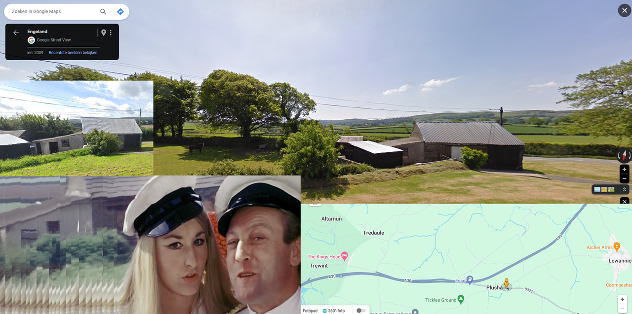
This is the approach to Mountjoy, just a few miles before Newquay, which would make it probably the 12th.
Looking to the roofs and chimneys guess it's the right spot:
Although it seems the the first building with two chimneys ( ridge line parallel to the road) is missing but perhaps replaced:
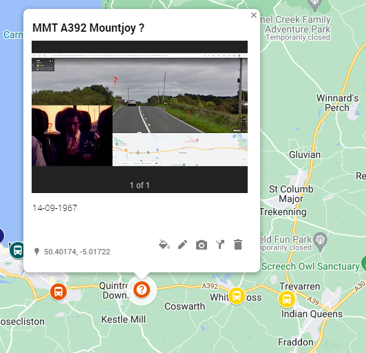
So I think as you suggest it's from the 12th and it is a continuation of the scene started in Bodmin. I think it could also a conform the 'Mountjoy railway crossing" which I put on the 14th with a question mark. So is it safe to place it in the 12th?
( Is it even possible the Kingshead is also from the 12th, although Paul's clothing matches the 14th and perhaps not the 12th)
Mountjoy Railway crossing on the 12th sounds good to me. I suppose some of the dates will always have to be a best guess.
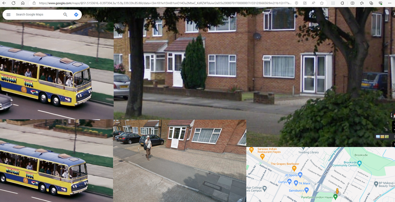
Can't post screen shots at the moment but there is a scene where Jolly Jimmy and Miss Winters are discussing Mr Bloodvessel, and they pass a few (farm?) buildings. Might be able to find that location.
This one has always confused me. A quite distinctive horizon but doesn't seem to fit with the seemingly similar shots in the sequence. The "lads and lasses" scene seems to be slate 4, whereas this very brief snippet is slate 5. I'm assuming that there is a slate per scene and each slate could have numerous takes. The view seems to rural to be on the approach to Plymouth/embankment Road, so could this be after the lunch stop at Plymouth?
That's a difficult one.
The Marsh Mills area has seen major redevelopment since 1967 and comparison between contemporary and older maps show there were a fair amount of housing and industry in the area even back then. Suffice to say the Devon Expressway, and the huge flyover and roundabout complex confuses things. They arrived c1981. Many of the hills have been built over too.
I guess the clues are the hill and trees on the horizon and the white house just in front of them. The area may not be as rural as it appears in the 1967 clip as the bus does appear to be between two car parks. The road layout was much simpler in 1967 - instinct would suggest the location is just as you leave Plymouth Road and (in those days) take a left onto Crabtree Road, which then becomes Embankment Road. However there is no white house and nothing resembling the hill with trees - unless it is now the hill with the dry ski slope on it (there is also a rather unpleasant housing estate there too) where Leigham Tower was. Not sure the angle of approach matches up though.
Although on leaving Plymouth, Miss Winters resumes her place at the microphone (we see the Tamar Bridge in the background at one point), I can't match the view with anywhere on the route towards Bodmin. The nearest is the gentle hill leaving Saltash (in those days the bus would have passed through along North Road/New Road/Liskeard Road) where a similar but smaller hill and field pattern is just about visible on Google maps. No sign of a white house anywhere.
The view from the a38 flyover above Marsh mills roundabout looking north/north east is a possibility for the same hillside horizon. There is a white house in that direction (but now obscured). Although they wouldn't have logically come off the roundabout in that direction, so not sure.